Trans Asia Photography Review:
From Cell Phone Camera to Satellite Sensor
Curated satellite images for TAP Review Volume 5, Issue 2: Vital Signs: Photography and Eco-Activism in Asia, Spring 2015.
See the full issue here or the snippet below:

“Humans have long been intrigued with the bird’s-eye view of their world. The first aerial photographs were made from hot-air balloons "in the nineteenth century. In the twentieth, photographs from aircraft became possible, then images made from satellites outside Earth’s orbit. Now, in the twenty-first century, satellite images are widely accessible; they are used for a variety of purposes by governments, corporations, nonprofit organizations, and individuals.
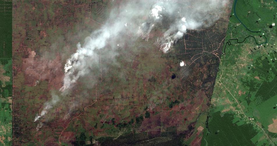
“We would like to call attention here to the work of the nonprofit organization Global Forest Watch (GFW) (www.globalforestwatch.org), an initiative of the World Resources Institute. GFW has partnered with the private satellite company Digital Globe to track the health of forests worldwide via satellite imagery. One of its projects, undertaken in collaboration with government authorities in Indonesia, involves monitoring the forest fires that are deliberately set to clear peat land for palm-oil plantations. In addition to being illegal, these fires devastate the forests and fill the air with a toxic, smoky haze. Digital Globe provides GFW with high-resolution satellite images that enable it to pinpoint the location of fires as they blaze. GFW staff overlay the images with maps and present this information to local authorities, who are then able to put out the fires and, in some cases, take legal action.”